Madagascar lies just off the eastern coast of Africa and is the world’s fourth largest island, covering an area of 587,041 km2. The exotic island is an ideal travel destination for nature enthusiasts who will be fascinated by the immense biodiversity and the great variety of Madagascar’s landscapes.
From the forested mountains of the north, the rainforest of the east coast, the steppe landscape in the island’s centre to the dry desert of the south with its famous baobabs, Madagascar is an island with many different faces. Visitors to Madagascar have the unique opportunity to explore a vastly diverse range of different sceneries all on one island and be amazed by landscapes that developed in isolation for millennia. So, lean back and learn more about the diversity of Madagascar’s landscapes in this article.
The highlights of Madagascar’s landscapes
Madagascar is divided into four geographical zones: The Central Highlands, the North, the West and the South-west. The Central Highlands make up almost two thirds of the entire Madagascan Island, with its highest point being the 3000 m tall Maromokotro. The Southwest is the driest part of the island. The vegetation in this area is made up of succulents, baobab trees, and a spiny forest in the south.
With so many different natural highlights, it’s not easy to decide which are the top places you definitely can’t miss. Here is our top 5 of Madagascar’s landscapes to help you plan your trip:
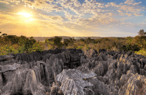
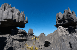
The Tsingy Bermaraha National Park
The eerie, otherworldly landscape of Bermaraha with its jagged topography of gigantic limestone needles (tsingys) is a protected UNESCO World Heritage Site.
It is situated on the western coast of Madagascar about 820 km west of Antananarivo. The Tsingy is one of the most spectacular landscapes of Madagascar with its network of rifts, deep cracks, and sharp limestone spikes. It is also home to 11 different species of lemurs, which you can spot jumping around the spiky rocks.
Royal Hill of Ambohimanga
The Royal Hill of Ambohimanga is a site of highest cultural and historical significance in Madagascar. It lies about 24 km to the east of the capital city of Antananarivo. Ambohimanga, which means “blue hill”, has been a sacred spot for the Malagasy people for over 500 years.
The royal city was the religious capital, seat of royal dynasties and the royal burial ground for kings from the 16th to the 19th century. With its exceptional architecture and authentic landscape, it’s definitely a place worth discovering.
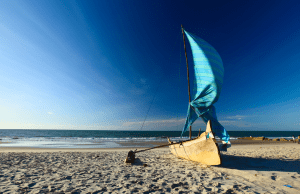
Ifaty
Ifaty is the collective name given to the picturesque fishing villages of Ifaty-Mangily and Madio Rano on the southwest coast of Madagascar. The Ifaty region is delightfully laidback, making it an ideal beach destination to unwind or to watch the traditional “pirogue” fishing boats. Behind the villages lies the arid spiny forest of the Reniala Nature Reserve.
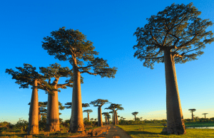
The Avenue of the Baobabs
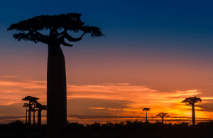
Avenue of Baobabs is the name of a dirt road in the Menabe region of Madagascar, linking Morondava and Belo Tsiribihina.
The avenue is framed by dozens of rare, ancient baobab trees that create a truly beautiful and unique scenery. The majestic trees are around 30 metres tall and many of them are more than 800 years old. The baobab species found here is the Adansonia grandidieri which is endemic to the island of Madagascar.
Tsarabanjina
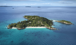
The small private island of Tsarabanjina, home to the laidback luxury of the Constance Tsarabanjina resort, is a tiny islet of the Mitsio Archipelago, off the northwestern coast of Madagascar. Tsarabanjini is a real gem with powder soft, white sand beaches and clear blue water that surround an interior of tropical forests.
The island is home to the tomb of the Sakalava kings of the Mitsio islands still honoured by locals today. Tsarabanjina is a perfect spot to snorkel beautiful reefs and to observe sea turtles.
Read more
- Discover the delights of Malagasy cuisine
- Find out about top 10 things to do in Madagascar
- Discover the perfect time to go whale watching in Madagascar


